PROFESSIONAL. PRECISE. RELIABLE.
BOUNDARY
SURVEYS
Professional boundary determination services for property owners, attorneys, developers and real estate professionals throughout Northern California.

WHAT IS A BOUNDARY SURVEY?
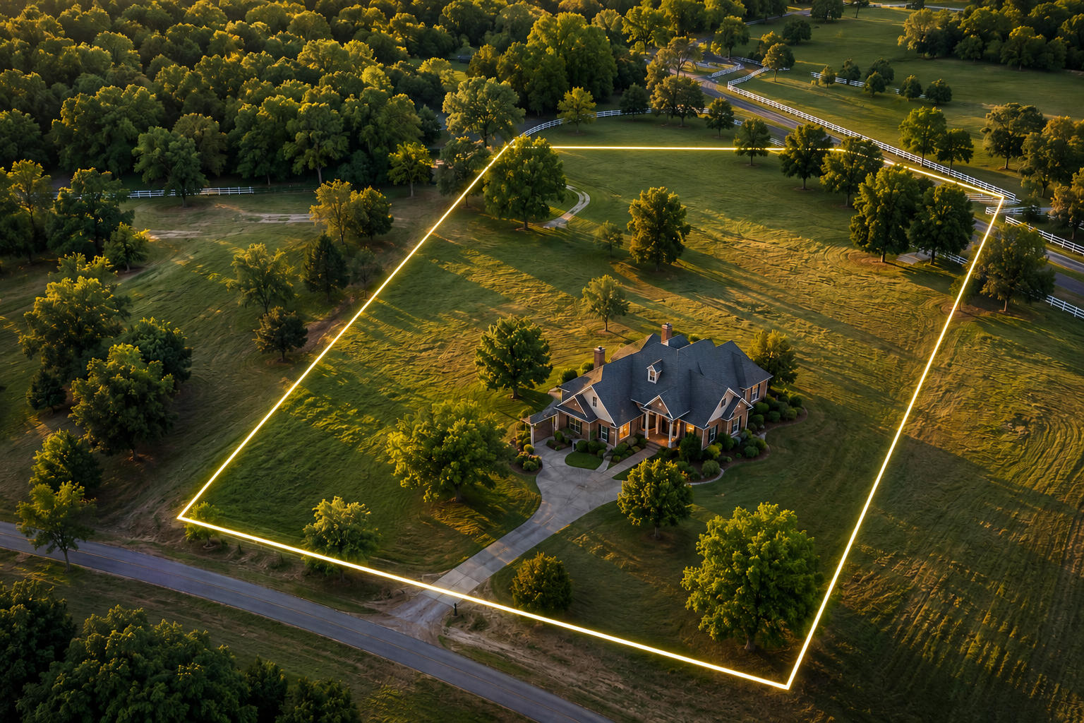
A Boundary Survey retraces the location of property lines through research, field investigation, geospatial data analysis, and professional judgement based on the available evidence.

-
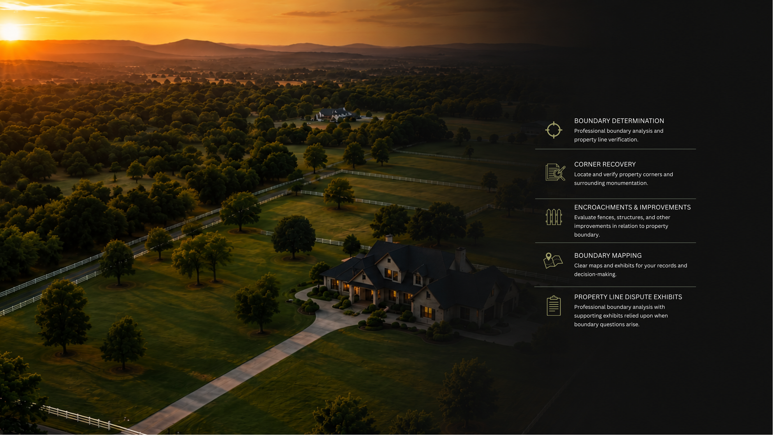
A boundary survey is recommended before building a fence, retaining wall, addition, driveway, pool, or other improvements near a property line. It can also help resolve uncertainty regarding property corners, boundary locations, easements, or potential encroachments before they become costly issues.
-
Property lines are not determined by GIS maps, fence lines, or assumptions. A licensed land surveyor researches deeds, maps, recorded documents, and historical evidence, then performs field measurements and analyzes available evidence to determine the most defensible boundary location under applicable surveying principles and laws.
-
A boundary survey can identify potential encroachments and provide clear documentation of the relationship between improvements and the property boundary. This information often helps property owners, attorneys, title companies, and neighboring landowners understand the facts before making decisions regarding disputes, easements, agreements, or future improvements.
-
Online GIS maps, assessor maps, and real estate websites are useful reference tools, but they should not be relied upon to determine property boundaries. These maps are often approximate and may contain positional errors. Only a professional boundary survey can establish the location of property lines on the ground.
CLARITY. CONFIDENCE. CERTAINTY.
Know Where Your Property Begins and Ends.
Our boundary surveys provide the clarity you need to make informed decisions and protect your property.